


Marking the 15-year anniversary of the New London Architecture galleries, the Changing Face of London revisits its 2005 exhibition to capture the transformation of the city’s famous landmarks. Aerial photographer Jason Hawkes talks us through his images
I have been photographing aerial views over London from helicopters for more than 25 years. I first flew in the capital when I was 22, and looking at images from then it is incredible how much some areas have changed.
We normally fly at an altitude of 750ft to 2,450ft. Things used to be a little more relaxed, which is why for instance the Battersea image from 15 years ago was shot from a much lower height than when I redid it last week.
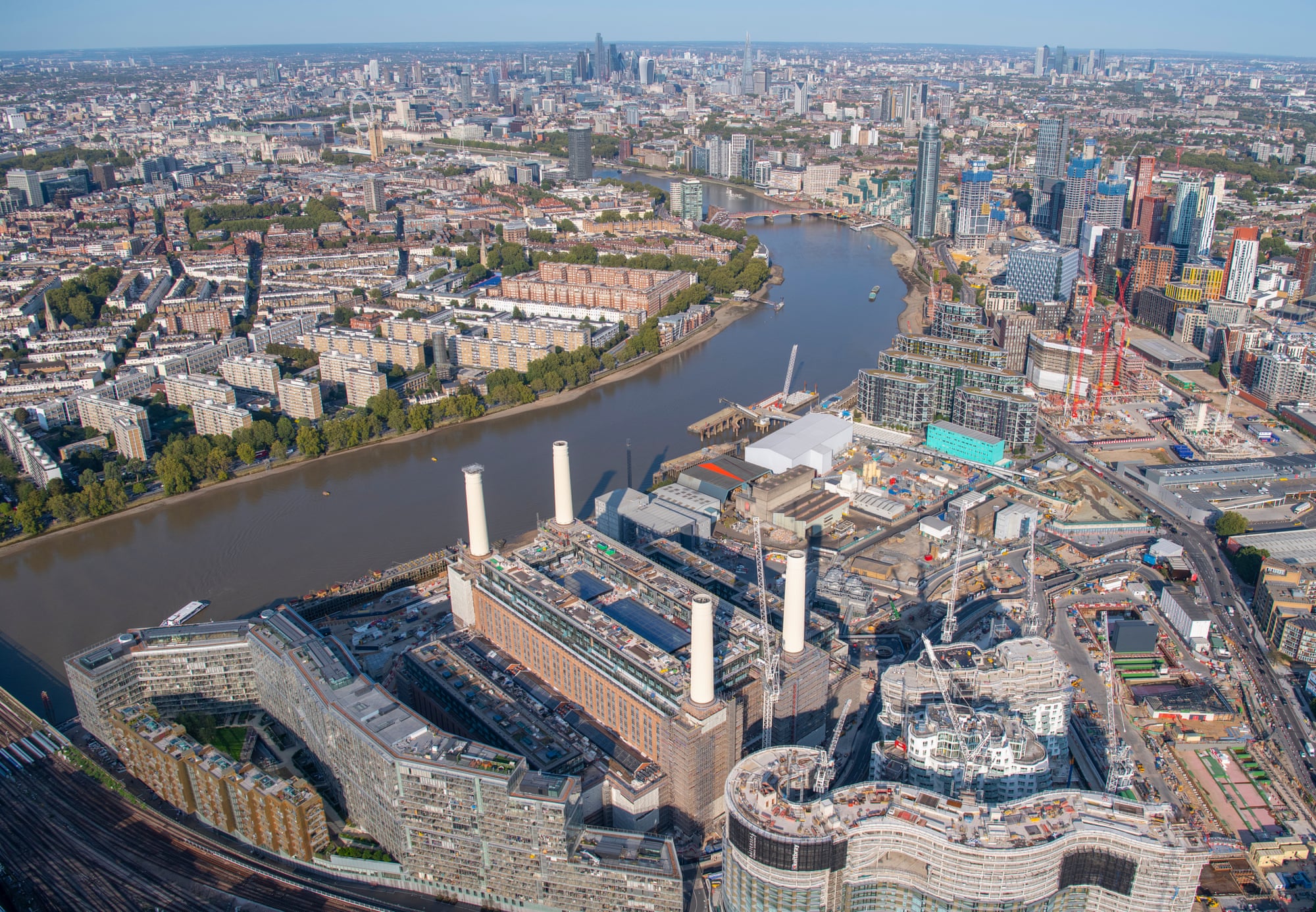
Battersea power station, River Thames, Battersea and Pimlico, 2005 and 2020
Development of Battersea power station, Nine Elms and Vauxhall.
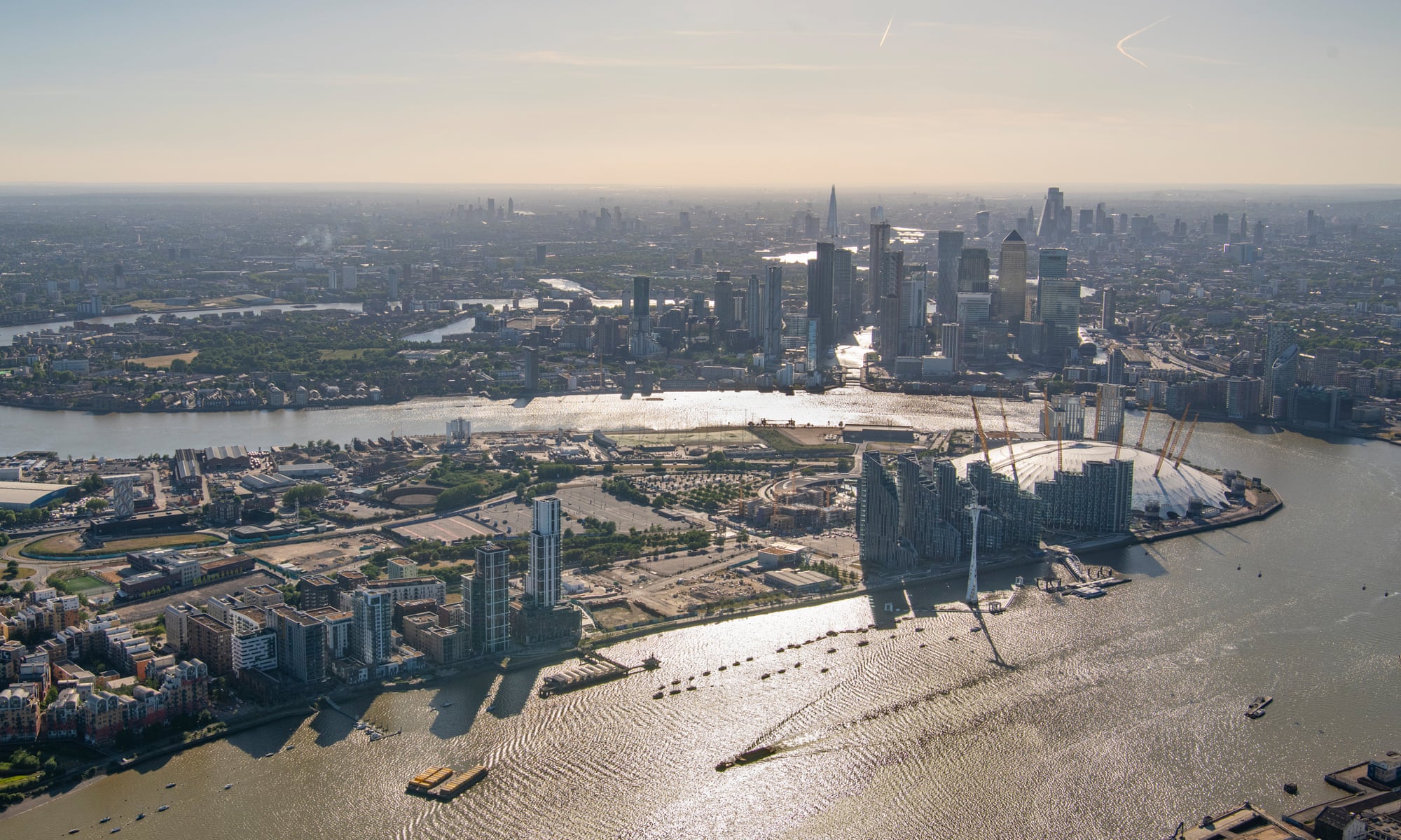
Greenwich peninsula: 2007 and 2020
St Pancras International and King’s Cross, looking north: 2006 and 2020
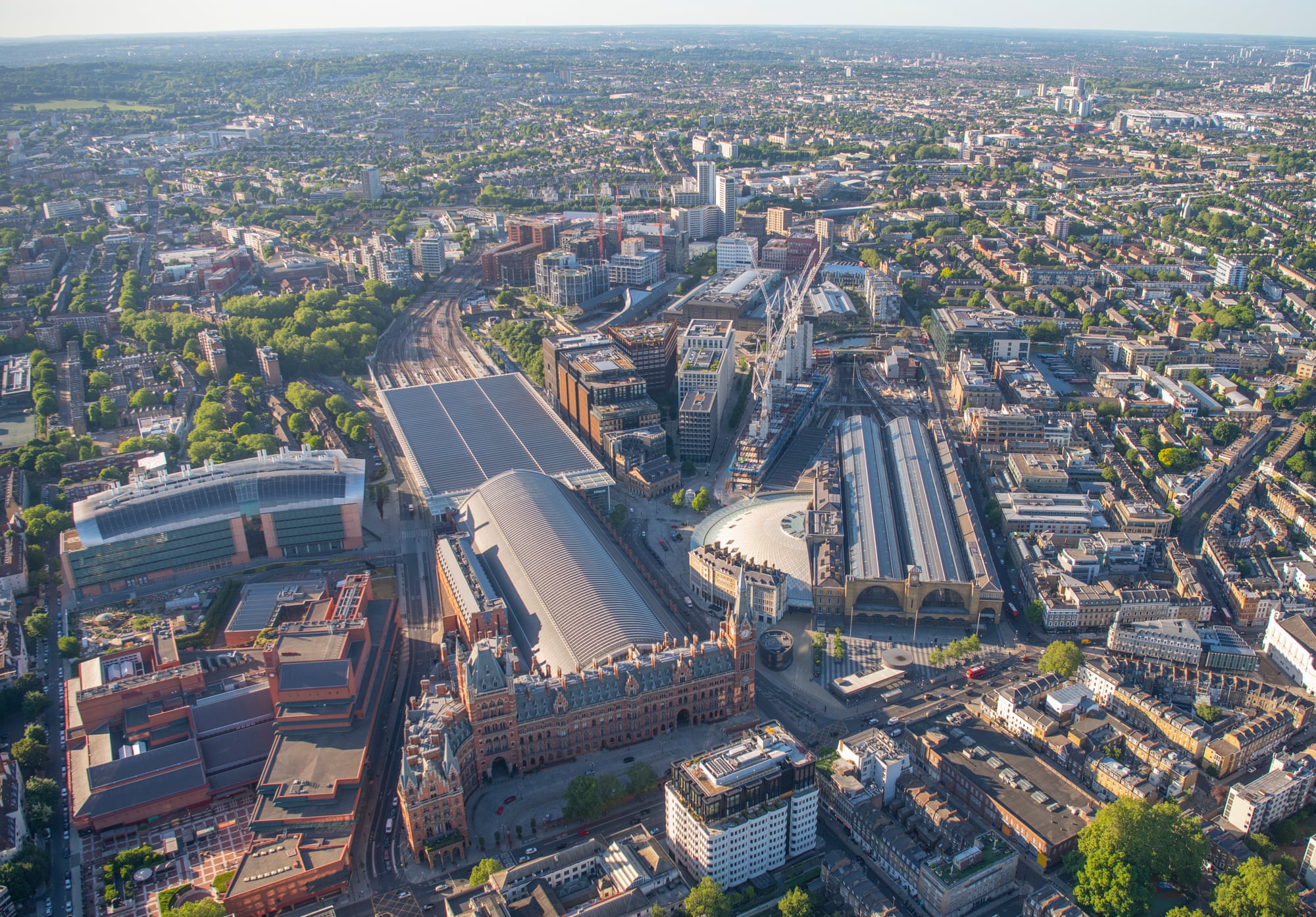
One of the most dramatic redevelopment projects in London in the past 15 years has been the huge construction works around Granary Square and Cubitt Square, including the Guardian office at Kings Place, and the Google “landscraper” development currently under construction.
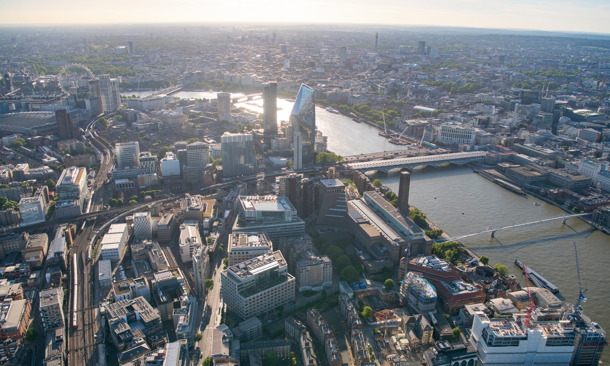
Bankside and Blackfriars – looking east from Tate Modern to Blackfriars Bridge: 2006 and 2020
This combination shows the extent of the development around Blackfriars, including the 1 Blackfriars building, also known as the Vase or Boomerang because of its unusual shape.
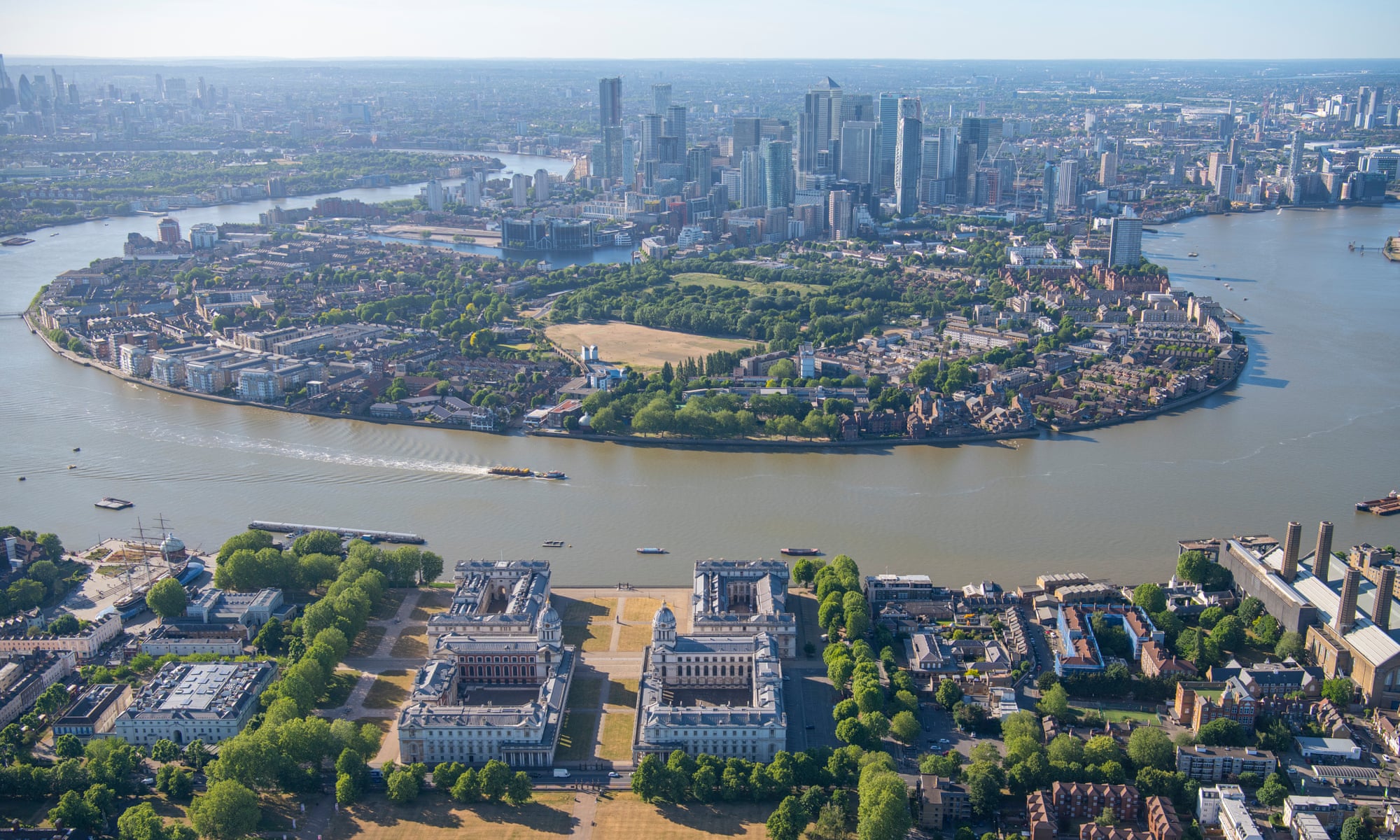
Old Royal Naval College to the Isle of Dogs, 2006 and 2020
Although the Isle of Dogs has changed little, this view shows the extent of development in Canary Wharf.
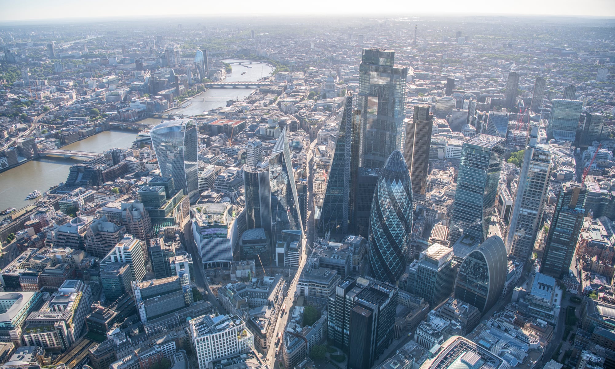
City of London – looking west: 2006 and 2020
This is one of my favourite views of the City of London and also the part that changes the most, particularly over the past five years. The newest building, 22 Bishopsgate, has transformed the skyline.
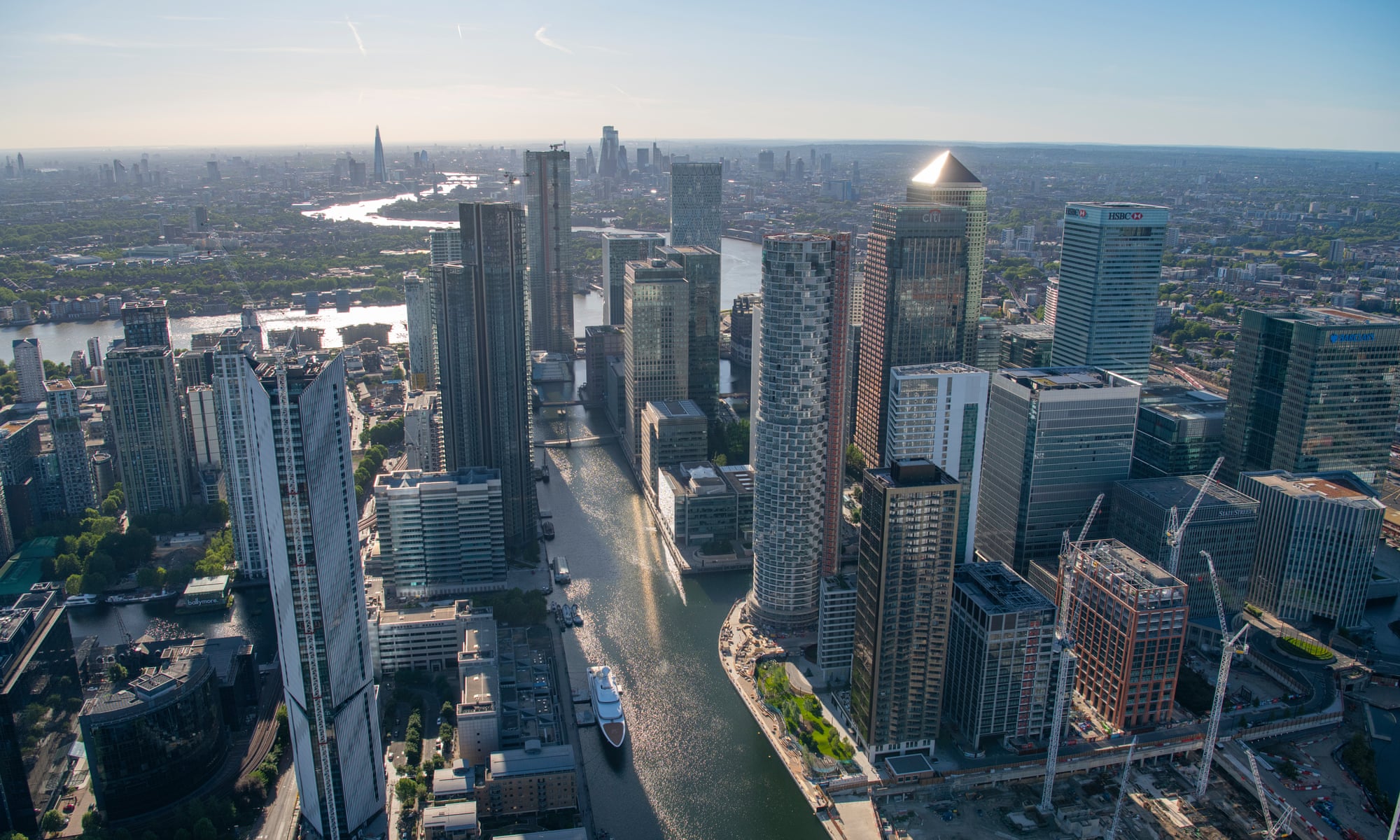
Looking west down South Dock in Canary Wharf: 2005 and 2020
Flying around Canary Wharf can get very busy as you are always subject to aircraft at the nearby City airport. When shooting at dusk we sometimes get only a tiny 30-second break from air traffic in which to grab the shots. It’s been amazing recently as the coronavirus restrictions have meant there are so few flights. Last weekend we flew there and had a free rein to fly as much as required.
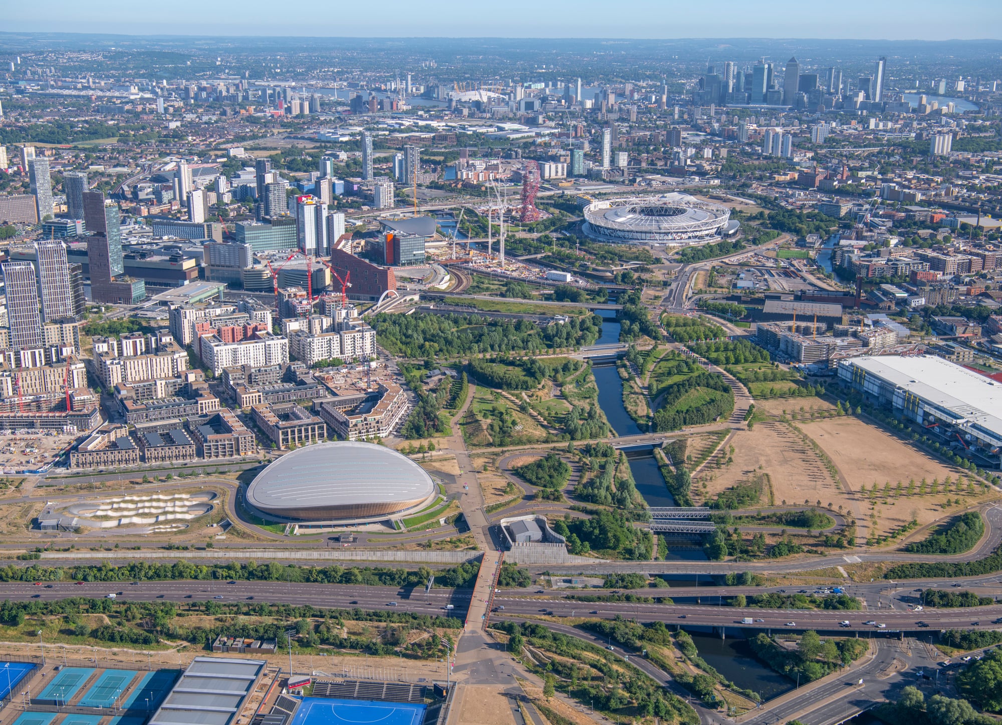
Construction of the Olympic site – looking south from the A12 down the River Lea: 2006 and 2020
While shooting in the winter, as we did to capture this first image, it can get desperately cold up there. We fly with the doors off, and after an hour or so you can’t feel your fingers. The matching image, shot in 2020, shows the site now known as Queen Elizabeth Olympic Park.
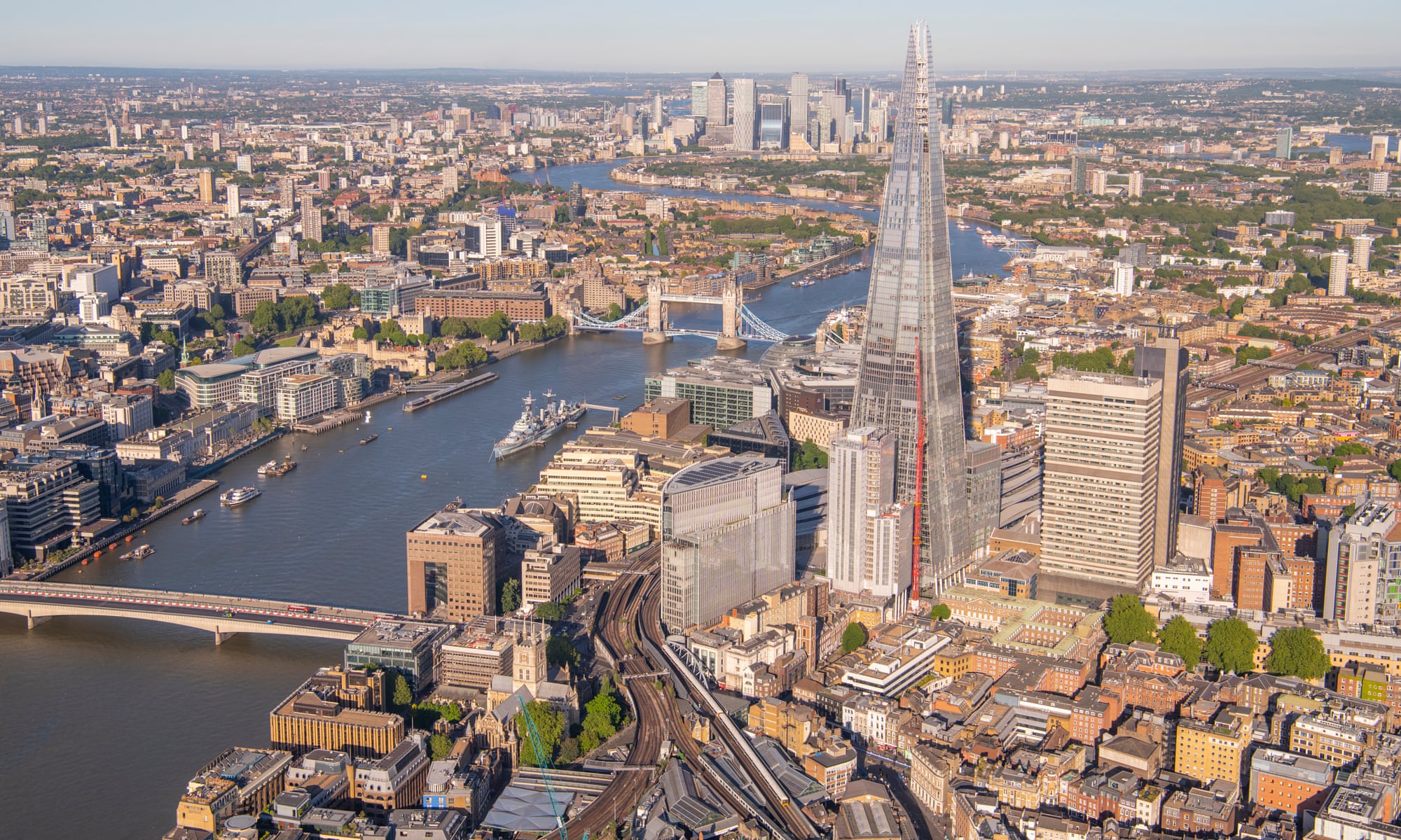
Looking east over London Bridge: 2005 and 2020
This view over London Bridge and the Tower of London shows the scene before and after the construction of the Shard.
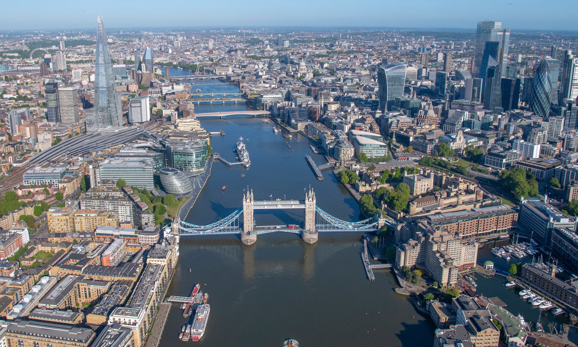
Tower Bridge – looking west: 2006 and 2020
This is a view I shoot more than any other, as it changes so much because of the tide and light off the Thames. The original shot from 2006, and the matching view this year, show the most prominent additions to the London skyline of the Shard and 220 Bishopsgate.
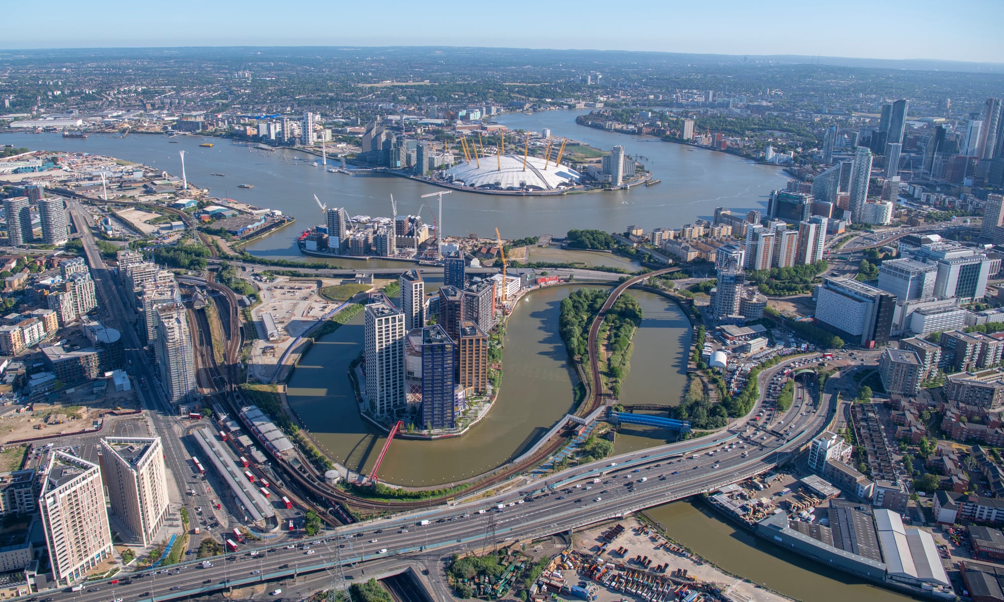
Looking south over the River Lea, Canning Town and the Leamouth peninsula: 2006 and 2020
The newly named London City Island development houses the English National Ballet, and a distinctive red footbridge links the old Leamouth peninsula to Canning Town.
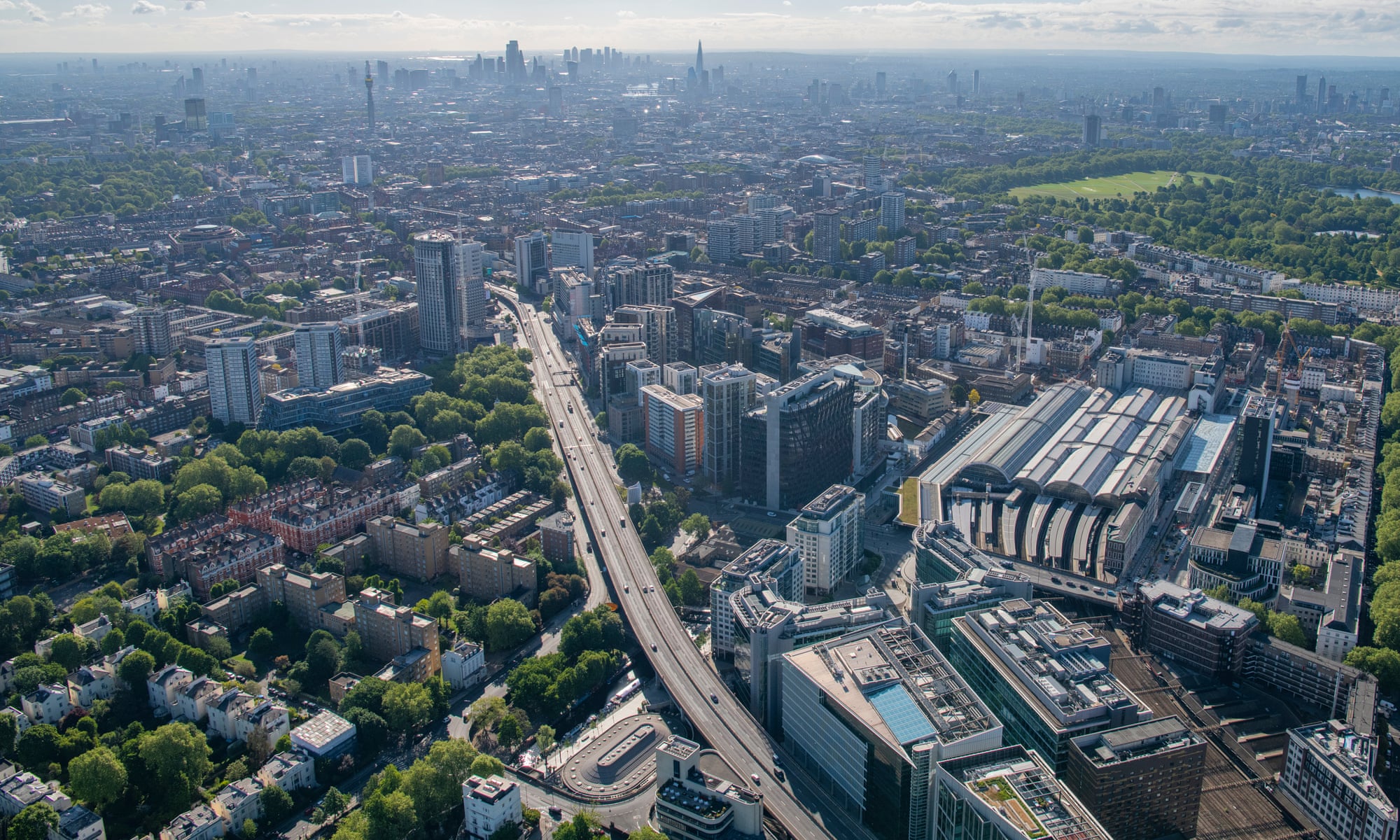
Looking west over Paddington and A40: 2006 and 2020
The development around Paddington, Paddington Central and Paddington Basin in west London.
View of the City of London, from Finsbury Circus, 2006 and 2020
The latest skyscrapers, 22 Bishopsgate and 100 Bishopsgate, as well as the newest development, One Crown Place, in the lefthand foreground.
